The Altiplano is an area of inland drainage (endorheism) lying in the central Andes, occupying parts of northern Chile and Argentina, western Bolivia and southern Peru. Its height averages about 3,750 meters (12,300 feet), slightly less than that of the Tibetan Plateau. Unlike conditions in Tibet, the Altiplano is dominated by massive active volcanoes of the Central Volcanic Zone to the west, such as Ampato (6288 m), Tutupaca (5816 m), Parinacota (6348 m), Guallatiri (6071 m), Cerro Paroma (5728 m), Cerro Uturuncu (6008 m) and Licancabur (5916 m), and the Cordillera Real in the north east with Illampu (6368 m), Huayna Potosi (6088 m), Janq'u Uma (6427 m) and Illimani (6438 m). The Atacama Desert, one of the driest areas on the planet, lies to the southwest of the Altiplano; to the east lies the humid Amazon Rainforest.
Sunday, 29 September 2013
Templo de Raqchi, Peru
Raqchi is an Inca archaeological site in the Cusco region in Peru also known as the Temple of Wiracocha, one of its constituents. The most prominent structure is the Temple of Wiracocha, an enormous rectangular two-story roofed structure that measures 92 metres (302 ft) by 25.5 metres (84 ft). This structure consists of a central adobe wall some 18 to 20 meters in height with an andesite base. Windows and doors allow passage. It is flanked on each side by a row of eleven columns. The foundations measure 4 metres (13 ft) for both the wall and the columns are classic high Inca stonework with the remaining height built of adobe. Prior to its destruction by the Spaniards, the temple had what is believed to be the largest single roof in the Incan Empire, having its peak at the central wall, then stretching over the columns and some 25 metres (82 ft) beyond on each side. The huge proportions of the temple, and its prominence on the site explain why the whole complex is also sometimes referred to as the Temple of Wiracocha.
Saturday, 28 September 2013
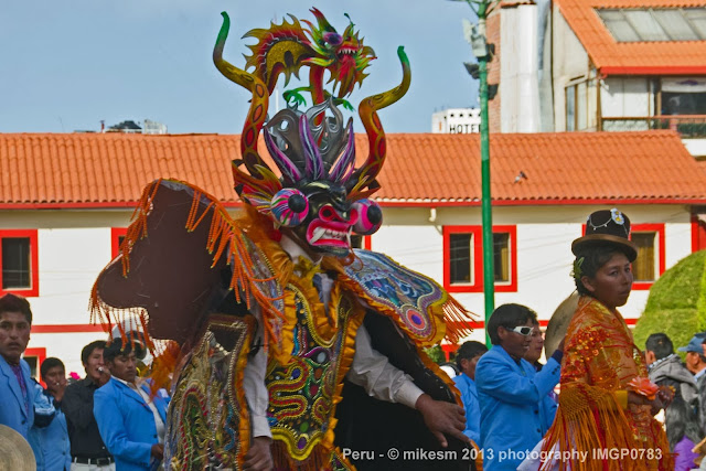
Puno, Peru
Puno is a city in southeastern Peru, located on the shore of Lake Titicaca. It is the capital city of the Puno Region and the Puno Province with a population of approximately 100,000. The city was established in 1668 by viceroy Pedro Antonio Fernández de Castro as capital of the province of Paucarcolla with the name San Juan Bautista de Puno. The name was later changed to San Carlos de Puno, in honor of king Charles II of Spain.
Aguas Calientis, Peru
Machu Picchu Pueblo, also known as Aguas Calientes is a location in Peru situated in the Cusco Region, Urubamba Province. It is the seat of the Machu Picchu District. Machu Picchu lies at the Willkanuta River. It is the closest access point to the historical site of Machu Picchu which is 6km (3.7 miles) away or about a 1.5 hours walk. There are many hotels and restaurants for tourists, as well as natural hot baths which gave the town its colloquial Spanish name.
Subscribe to:
Posts (Atom)


